About this Cyclone Ditwah Tirupati guide — please read first. Tirupati Official is an independent news and information site. We are not the Tirumala Tirupati Devasthanams (TTD), not a government body, and not an official weather or disaster-management authority.
We issue no alerts, and we take no bookings or donations. For live weather warnings, check the India Meteorological Department. For darshan, check the official TTD portal. In an emergency, call the official helplines listed near the end of this guide.
If you searched for a Cyclone Ditwah Tirupati update during that tense week in late November 2025, you were really asking one thing: was it safe to travel and take darshan? This page now serves as a plain record of what happened, so pilgrims and residents can understand the event.

The short answer is reassuring. Ditwah spared Tirupati its worst, although it did bring a red alert, heavy rain, and gusty winds to the district. Below is what actually took place, why it mattered, and what to do if a cyclone ever crosses your Tirupati trip again.
Quick recap: what Cyclone Ditwah Tirupati residents actually saw
Cyclone Ditwah stayed offshore and never made a hard landfall on the Andhra coast. Even so, the India Meteorological Department placed Tirupati district under a red alert for 30 November 2025. Heavy rain and squally winds followed, yet the district avoided the deadly flooding that struck Sri Lanka.
- Storm window: the system lasted from 26 November to 4 December 2025.
- Worst impact: Sri Lanka, where flooding and landslides killed hundreds and caused over a billion dollars in damage.
- Tirupati: a red alert on 30 November, with heavy rain and winds gusting to around 80 kmph, but no major damage reported.
- Darshan: pilgrims faced wet, slower travel, so confirming timings on the official TTD portal was essential.
- Helplines: the state disaster authority ran toll-free lines on 1070, 112, and 1800-425-0101.
What Cyclone Ditwah was and where it went
Cyclone Ditwah was a tropical cyclone that formed over the southwest Bay of Bengal on 26 November 2025. Yemen suggested the name, which refers to a lagoon. Because the system drew energy from a warm sea, it strengthened from a low into a cyclonic storm within roughly a day.
One detail stood out to forecasters. Ditwah formed in the southwest Bay of Bengal, a zone that spawns fewer cyclones than the northern bay. They also called it weak but catastrophic, since its damage came from relentless rain rather than fierce wind.
The storm first battered Sri Lanka, and that is where the tragedy fell hardest. Officials there later linked Ditwah to 647 deaths, with 183 people missing and damage above 1.64 billion dollars. It became one of the island’s worst flood disasters since the early 2000s. Whole districts flooded, while landslides cut off hill towns.
After crossing Sri Lanka, Ditwah drifted back into the Bay of Bengal and tracked north along the Tamil Nadu coast. While it approached, it stayed just offshore and began to weaken from 30 November. It faded into a deep depression, then a remnant low on 3 December, before dissipating on 4 December 2025.
How Cyclone Ditwah affected Tirupati and the Rayalaseema region
Tirupati sat on the storm’s inland edge, so it never took a direct hit. Still, the threat was real enough for the IMD to issue a red alert for 30 November across Nellore, Tirupati, Chittoor, Kadapa, Prakasam, and Annamayya districts. Forecasters warned of heavy to very heavy rain, with squally winds of 60 to 70 kmph gusting to 80 kmph.
The Andhra Pradesh State Disaster Management Authority monitored the system from its emergency operations centre. Because rough seas were expected, fishermen were called back from the water. Farmers were also advised to protect harvested crops, since strong winds and rain can flatten a standing yield quickly.
Rain lingered over south coastal Andhra Pradesh and Rayalaseema from 30 November into early December. Tirupati and Chittoor saw wet, blustery weather during that spell. Fortunately, the district reported no loss of life or serious damage, so the disruption stayed limited to travel delays and waterlogging.
A red alert is the IMD’s most serious rainfall warning. It signals extremely heavy rain, often above 20 cm in a single day, and it tells local authorities to act at once. For pilgrims, a red alert is the clearest sign to pause outdoor plans and wait for the next bulletin.
In the town below the hills, heavy spells like these tend to pool on low-lying roads and slow local buses. Autos and taxis still ran, although fares often climb when demand spikes in bad weather. For most visitors, then, the practical effect was a slower, wetter journey rather than a cancelled one.
How Ditwah fit the recent cyclone pattern
Ditwah did not arrive out of nowhere. Just a year earlier, in late November 2024, Cyclone Fengal followed a similar script. It made landfall near Puducherry, and it too pushed heavy rain into Rayalaseema and coastal Andhra Pradesh.
That back-to-back timing matters for anyone planning a trip. Because two straight years brought a late-November storm, the Cyclone Ditwah Tirupati experience is best read as a pattern rather than a freak event. So a pilgrim booking for late autumn should always keep a wet-weather backup plan.
The wider takeaway is about preparation, not fear. India’s forecasters flagged Ditwah days ahead, so districts had time to warn residents and recall fishermen. That early warning is exactly why the region saw disruption instead of disaster.
Cyclone Ditwah Tirupati timeline: how the storm unfolded
The event moved fast, so a simple day-by-day view helps. This timeline tracks the storm from formation to its fade, with the Tirupati angle highlighted where it applies.
| Date | What happened |
|---|---|
| 26 Nov 2025 | Ditwah formed over the southwest Bay of Bengal. |
| 28 Nov 2025 | The storm hit Sri Lanka, while Andhra Pradesh began preparing. |
| 29 Nov 2025 | The IMD issued a red warning for north Tamil Nadu, Puducherry, and adjoining south Andhra. |
| 30 Nov 2025 | Tirupati district came under a red alert; heavy rain and gusty winds arrived. |
| 1–2 Dec 2025 | Rain eased as the system weakened into a depression offshore. |
| 3–4 Dec 2025 | Ditwah became a remnant low and then dissipated. |
Travel and darshan during the storm
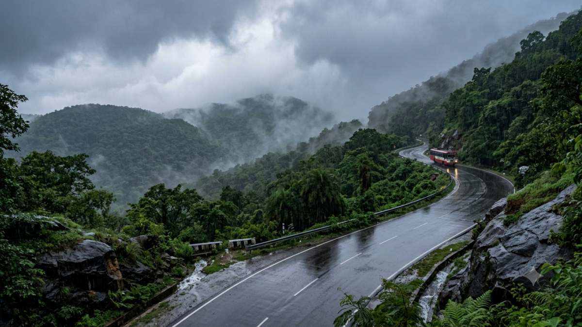
Travel was possible during Ditwah, though it demanded caution. Because the ghat roads to Tirumala wind through steep bends, heavy rain made them slick and slow. Bus and rail services across the wider region also saw weather-related delays while the alert held.
On the ghat roads, wet weather like this usually slows buses and cabs rather than stopping them outright, unless authorities order a halt. During the Cyclone Ditwah Tirupati alert, the sensible move was to leave extra time and drive gently. Anyone prone to motion sickness felt the winding climb more sharply in the rain.
Darshan itself was not officially cancelled by any report we could verify. However, wet weather naturally slows queue movement and outdoor waiting. Pilgrims were therefore advised to check the official TTD portal for the latest timings, rather than rely on rumours. You can follow ongoing TTD darshan and seva updates for routine changes too.
Cyclone Ditwah Tirupati lessons: staying safe if a storm hits your trip
Ditwah was a near-miss for Tirupati, yet the next system may not be. Cyclone season on the east coast runs mainly from October to December, so any late-year pilgrimage carries some weather risk. These steps keep you safe and calm if rain closes in.
Before you travel
Check the IMD forecast for Tirupati and Chittoor before you book anything firm. If a red or orange alert is live, consider shifting your dates by a few days. Keep your phone charged, and save the disaster helpline numbers in your contacts.
During heavy rain in Tirumala
Stay on marked paths and paved roads, because hill slopes can loosen after long rain. Never wade or drive through moving floodwater, since even shallow flow can sweep a person off their feet. Avoid sheltering under lone trees during lightning, and move indoors instead. Keep children within arm’s reach on wet steps and ramps.
What to pack for a rainy visit
A light rain poncho beats an umbrella on the windy hilltop, because gusts turn umbrellas inside out. Pack quick-dry clothes, a waterproof pouch for your phone and documents, and sturdy non-slip footwear. A small torch helps too, since power can flicker during a heavy storm. Layer up as well, because hill evenings turn cold once the rain sets in.
If you are travelling with family
Elderly pilgrims, pregnant travellers, and young children feel weather stress fastest, so build in extra rest. Carry any regular medicines in your hand baggage, along with dry clothes and drinking water. When an official advisory says stay put, follow it, even if it means missing a slot.
Official sources to check during any cyclone or heavy rain
During a live storm, trust primary sources over social media. The following official channels give verified warnings, timings, and emergency contacts for the Tirupati region.
- India Meteorological Department: live cyclone bulletins and district alerts at mausam.imd.gov.in.
- AP State Disaster Management Authority: state alerts and helplines 1070, 112, and 1800-425-0101 at apsdma.ap.gov.in.
- Tirumala Tirupati Devasthanams: official darshan and seva timings at tirumala.org.
- National Disaster Management Authority: general cyclone safety guidance at ndma.gov.in.
Planning the journey itself is easier when the weather is calm. If you are mapping routes for a future visit, our guide to special train options to Tirupati covers the main rail links.
The bottom line for Tirupati pilgrims
Cyclone Ditwah ended up as a scare rather than a disaster for Tirupati, and that is worth remembering clearly. The district got a red alert, a soaking, and strong winds, but it escaped real harm while Sri Lanka suffered terribly.
The Cyclone Ditwah Tirupati episode leaves one simple lesson. Watch the IMD during the October to December window, keep official helplines handy, and treat any official advisory as the final word. Do that, and a rainy forecast need not derail your darshan.
Frequently asked questions about Cyclone Ditwah Tirupati
Did Cyclone Ditwah hit Tirupati directly?
No. The storm stayed offshore near the Tamil Nadu coast and weakened before it could make a hard landfall. Tirupati still came under a red alert on 30 November 2025, with heavy rain and gusty winds, but it saw no major damage.
Was TTD darshan cancelled during the storm?
No official suspension was reported that we could verify. Wet weather can slow queues and outdoor waiting, though, so pilgrims were advised to confirm live timings on the official TTD portal before setting out.
When did Cyclone Ditwah happen?
Ditwah formed on 26 November 2025 and dissipated on 4 December 2025. The heaviest weather over the Tirupati region fell around 30 November and the first days of December.
What does the name “Ditwah” mean?
Yemen suggested the name, and it refers to a lagoon. Countries around the North Indian Ocean take turns contributing cyclone names from a shared, pre-approved list.
Which Andhra Pradesh districts were under a red alert?
The Cyclone Ditwah Tirupati red alert covered Nellore, Tirupati, Chittoor, Kadapa, Prakasam, and Annamayya districts for 30 November 2025. Forecasters warned of very heavy rain and strong, gusty winds across those areas.
When is the riskiest time for cyclones near Tirupati?
The main east-coast cyclone season runs from October to December. Because most systems form in the Bay of Bengal during these months, a late-year visit carries a higher chance of heavy rain, so check the forecast first.
Is it safe to visit Tirupati during cyclone season?
Yes, in most cases, as long as you track the forecast. The Cyclone Ditwah Tirupati episode showed that alerts bring rain and delays more often than real danger. Still, if the IMD posts a red alert for your dates, it is wiser to wait a few days.
What emergency numbers should pilgrims keep handy?
Save the Andhra Pradesh disaster helplines: 1070, 112, and 1800-425-0101. These connect you to the state emergency system for weather warnings, rescue, and general safety help during any disaster.